


06-002, Marion County, Indiana
About
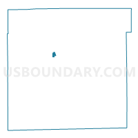
Outline

Summary
| Unique Area Identifier | 579582 |
| Name | 06-002 |
| County | Marion County |
| State | Indiana |
| Area (square miles) | 0.27 |
| Land Area (square miles) | 0.27 |
| Water Area (square miles) | 0.00 |
| % of Land Area | 100.00 |
| % of Water Area | 0.00 |
| Latitude of the Internal Point | 39.81562580 |
| Longtitude of the Internal Point | -86.18126440 |
Maps


Graphs
Select a template below for downloading or customizing gragh for 06-002, Marion County, Indiana


Neighbors
Neighoring Voting District (by Name) Neighboring Voting District on the Map
- 05-001, Marion County, IN
- 06-001, Marion County, IN
- 06-003, Marion County, IN
- 06-004, Marion County, IN